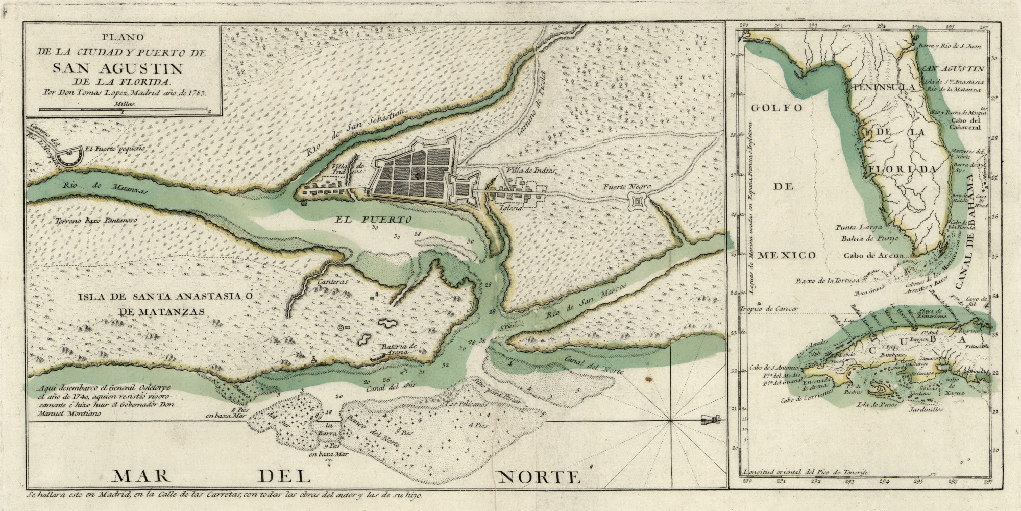
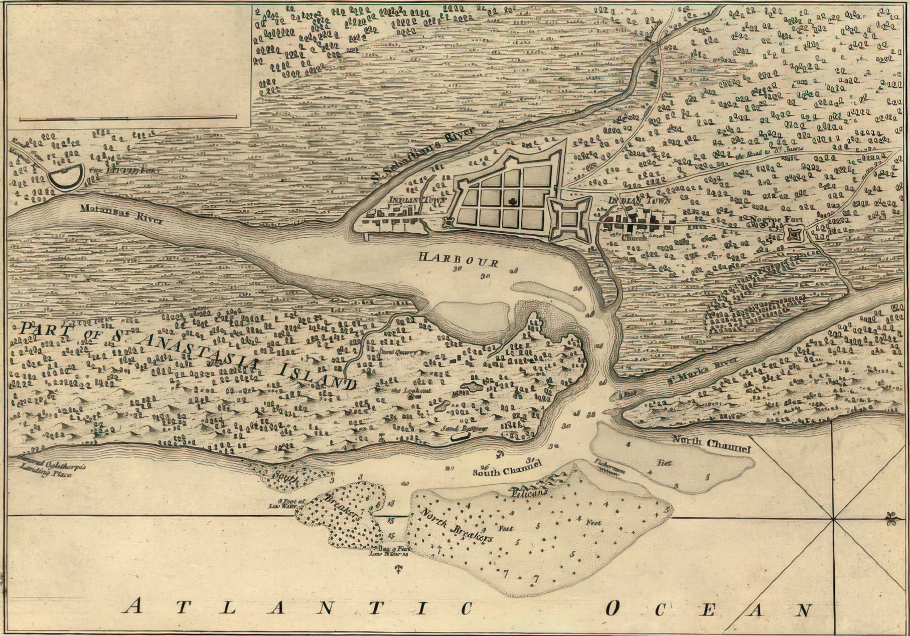
Maps of Fort Mose and St. Augustine
The maps below show St. Augustine and its harbor in the eighteenth century, the period when Fort Mose stood two miles to the north. In both plans the fort sits to the northeast of the harbor — labeled “Fuerte Negros” on the 1783 map and “Negroe Fort” on the 1763 map.