
The Defense Lines
The earthwork and moat that linked Fort Mose to the San Sebastian River, and the layered defenses of St. Augustine
Three lines of defense
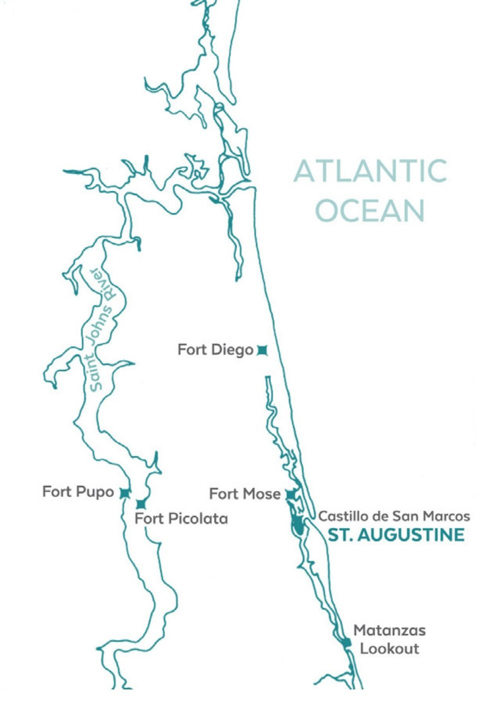
St. Augustine was not defended by a single wall but by a series of layered earthworks, each protecting the next. The Spanish built three roughly parallel lines running from the north side of the city to the San Sebastian River on the west, so that an attacker coming from the north — the direction of the British colonies — would have to break through three barriers before reaching the Castillo de San Marcos.(1)
The innermost was the Cubo Line (1704), which ran from the Castillo de San Marcos to the San Sebastian River, about a thousand yards in length. It featured earthworks, a palm-log stockade, a moat, and the historic City Gate. The middle was the Hornabeque Line (1706), placed further north and stretching river-to-river across the peninsula near San Carlos Street, within the firing range of the Castillo. It was built with logs and earth, and included a small bastion or lunette to shelter the native mission villages such as Nombre de Dios. The outermost was the Mose Wall (1762), the northernmost barrier, which connected to Fort Mose — the settlement established for free and formerly enslaved Africans who had escaped from the English colonies.(2)
The Fort Mose line
In 1762, the men of Mose added an earthwork and moat extending from the fort west to the San Sebastian River, a distance of about two miles. The line was built of earth and yucca — the same prickly-pear cactus (opuntia) that lined the moat around the fort itself — and it contained several triangular bastions along its length.(3)
A contemporary description calls it “a fortified line, a considerable portion of which may now be traced, extending across from the stockades on the St. Sebastian river to Fort Mosé.”(4) The English traveler William Stork, writing in 1769, described it as “another fortified line, with some redoubts, forming a second communication between a stockade fort upon St. Sebastian’s river, and fort Mosa upon the river St. Mark’s.”(5)
The line ran through an area that was, in the words of the Spanish engineer Mariano de la Rócue in 1789, “an impassable marsh, so that it is impossible for anybody to pass without becoming mired.” The only crossing was a causeway on the road to Apalache, and the line was built to guard that crossing. De la Rócue noted that “the English have preserved it” — the British had maintained the redoubt and the line after 1763 — and recommended restoring it, since it was “the point of attack in this place (St. Augustine), since all those who come from St. Mary and St. John certainly must come by this passage.”(6)
The Hornabeque Line
Built in 1706, the Hornabeque Line — also called the hornwork — was the middle barrier of the three. It stretched river-to-river across the peninsula near what is now San Carlos Street, within the firing range of the Castillo de San Marcos. The line was built with logs and earth and included a small bastion or lunette, and it served a dual purpose: it was a military defense and a shelter for the native mission villages, including Nombre de Dios, which lay just to its north.(13)
The Hornabeque was the first of the three lines to be built, and the Spanish garrison maintained it through the eighteenth century. By the time of the 1740 siege, it was a well-established work, and the British engineer William Stork, writing in 1769, described it as “a line with a broad ditch and bastions, running from St. Sebastian’s creek to St. Mark’s [North] river.”(14) The Spanish engineer de la Rócue, in 1789, judged that its “defense cannot be improved” and recommended only maintenance.(15)
The Cubo Line
Built in 1704, the Cubo Line was the innermost of the three defenses and the best documented. It ran from the Castillo de San Marcos to the San Sebastian River, about a thousand yards in length, and featured earthworks, a palm-log stockade, and a moat. A 1821 report by the Spanish engineer Ramón de la Cruz, translated and transmitted to the American authorities at the time of the relinquishment of Florida, gives its dimensions in detail: a continual parapet seven yards thick at the base and three to four feet thick at the crest, forming a sloping scarp down to a ditch forty-three feet wide and about six feet deep.(7)
At the foot of the scarp, along the line’s whole length, ran a palisade of palm logs nine feet high and six to eight inches thick, set in girders. The line contained three redoubts: the Tolomato redoubt, with a blockhouse and two guns on its flanks; the Medio Cubo, of the same figure and dimensions; and the Cubo Redoubt itself, a square work at the western end on the San Sebastian River, closed in by a thick palisade with two gun platforms.(8)
The only outlet in the line was the City Gate — the historic Land Post Gate on the north (Jacksonville) road, secured with ironwork and a folding door hung on two strong pillars. A bridge, seventy-eight feet long and sixteen and a half feet wide, crossed the moat at the gate. Guard houses stood at the City Gate and the Cubo Redoubt, each capable of housing eight men.(9)
Archaeological investigations carried out in 1937, 1938, and 1939 by the St. Augustine Historical Program excavated every part of the line except a short section near the grade school. The butts of practically all the palm-log palisade in the faces of the redoubts were found in good condition, despite the fact that more than a century had passed since they were last replaced.(10)
Side by side
The Mose Wall and the Cubo Line shared a purpose — to block the approach from the north — but they differed in scale, construction, and permanence. The Cubo Line was a formal military work, built and maintained by the Spanish garrison, with an earth parapet, a deep moat, and a palm-log stockade. The Mose Wall was a frontier work, built by the free Black militia of Mose with the materials at hand — earth, yucca, and the marsh itself — and it relied on the natural barrier of the San Sebastian marsh as much as on its own construction.
| Cubo Line (1704) | Mose Wall (1762) | |
|---|---|---|
| Built by | Spanish garrison | Free Black militia of Mose |
| Length | ≈1,000 yards | ≈2 miles |
| Parapet | Earth, 7 yd thick at base, 3–4 ft at crest | Earth and yucca |
| Moat | 43 ft wide, ≈6 ft deep | Moat, depth unknown |
| Stockade | Palm logs, 9 ft high, 6–8 in thick | Yucca (prickly-pear cactus) |
| Redoubts | Tolomato, Medio Cubo, Cubo | “Some triangular bastions” |
| Gate | City Gate / Land Post Gate (ironwork, folding door) | Causeway on the Apalache road |
| Artillery | 2 guns (Tolomato), 2 (Cubo platforms) | Unknown |
| Garrison (1736) | 6 infantry + 2 artillery (Medio Cubo + Cubo) | Mose militia (24 muskets) |
| Fate | In ruins by 1833; excavated 1937–39 | Preserved by the English; ruined by the 19th century |
What remains
Of the Cubo Line, the 1937–39 excavations confirmed that the palm-log stockade and the moat were still in the ground, though the earth parapet had long since crumbled. The line’s course can still be traced in the modern streets and parks of St. Augustine, and the old coquina bridge in front of the City Gate was partly uncovered and restored during the excavations.(11)
Of the Fort Mose line, far less survives. The marsh that the line crossed has been altered by drainage and development, and the earthworks have been largely eroded. The defense line that once ran west from the fort to the San Sebastian has left no visible trace, but its course can be followed on the old maps: from the fort, along the causeway, to the redoubt on the river.(12)
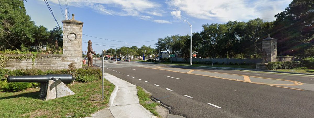
The gates on U.S. 1 — the two stone pillars with their bronze statues and their cannon — mark the entrance to the park and stand roughly where the line once began. They are a reminder that the fort was never an isolated post but the anchor of a defense system that stretched across the marsh to the river.
References
- 1. Verne E. Chatelain, The Defenses of Spanish Florida 1565–1763 (1941), ch. 14 (the three parallels). (return)
- 2. Chatelain, op. cit. (the Cubo line, the hornwork, and the northern parallel); William Stork, A Description of East Florida (1769) (the hornwork and the northern parallel). (return)
- 3. Kathleen Deagan and Jane Landers, “Fort Mosé: Earliest Free African-American Town in the United States” (1990) (the 1762 earthwork and moat); Florida Museum of Natural History education packet (1991). (return)
- 4. Zora Neale Hurston, “Communications,” Journal of Negro History 12 (1927), quoting Roberts and Stark, The History of English Occupation of Florida. (return)
- 5. William Stork, A Description of East Florida (3rd ed., London, 1769), p. 8. (return)
- 6. Mariano de la Rócue, report on the defenses of East Florida (1789), East Florida Papers, no. 176-2, Library of Congress. (return)
- 7. Ramón de la Cruz, report (1821), translated and transmitted by Lt. S. Tuttle, U.S. Army, 1833 (the Cubo line dimensions). (return)
- 8. De la Cruz report, op. cit. (the three redoubts and their armament). (return)
- 9. De la Cruz report, op. cit. (the Land Post Gate, the bridge, and the guard houses). (return)
- 10. Chatelain, op. cit., n. 67 (the 1937–39 archaeological investigations along the Cubo line). (return)
- 11. Chatelain, op. cit., n. 66–67 (the palisade logs, the coquina bridge, and the excavations). (return)
- 12. Deagan and Landers, op. cit. (the defense line and its course); Chatelain, op. cit. (the marsh and the causeway). (return)
- 13. Chatelain, op. cit., ch. 14 (the Hornabeque Line: 1706, river-to-river near San Carlos Street, logs and earth, bastion/lunette, shelter for Nombre de Dios). (return)
- 14. William Stork, A Description of East Florida (1769), p. 8 (the hornwork described as “a line with a broad ditch and bastions”). (return)
- 15. Mariano de la Rócue, report (1789) (the Hornabeque’s defense “cannot be improved”). (return)
See also: Fort Mose and Castillo de San Marcos on Wikipedia.